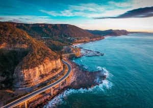

Embark on a Scenic Journey Across Mount Field’s Glacial Tarn-Studded Plateau
Tarn Shelf Circuit

This journey takes you across the ancestral lands of the Lairmairrener People/Big River Nation.
WHAT MAKES IT UNIQUE
Tasmania’s oldest nature reserve is a pretty special place. Many adventurers are drawn by the iconic waterfalls and lush fern-rich forests, but the journey to the road’s end at an altitude of 1040m introduces a contrasting alpine landscape. The ascent reveals stunning forests of native king billy, pencil pines, and pandani leading to a rocky spectacle studded with camera-friendly tarns. A quaint hut packed with 1930s ski gear adds a touch of history. The landscape is framed by the majestic Rodway Range, offering stunning views at every turn.
YOUR HIKING GUIDE
Generally, hikers complete this circuit anti-clockwise, saving the best scenery for the last stretch. But keep in mind, navigation is slightly simpler when going clockwise. Short on time? Opt to head straight for the Tarn Shelf – the round trip will take about 3 hours. Or, consider the beautiful 40-minute Pandani Grove circuit around Lake Dobson. Be prepared for 8km of dirt and gravel road after the sealed Mount Field Visitor Centre, leading to Lake Dobson carpark. Even though it’s manageable in a 2WD under good conditions, the road can get slippery when wet.
TRAIL DETAILS
Distance: 15km
Time: 5-6hr
Difficulty Level: Moderate to Hard
Terrain: Combination of dirt, boardwalk, and rock hopping. A few sections need careful navigation.
Intensity: Physically demanding hike with steady ascents and uneven ground.
Take Note: The trail is largely above the tree line. Always check the weather forecast and bring warm, waterproof clothing.
BEST TIME TO VISIT
The trail is most appealing from Spring to Autumn. Snow can happen anytime but it’s best to avoid winter when the track might be concealed or even closed. Autumn brings out the spectacular hues of the Nothofagus beech.
RESOURCES
For more details, visit parks.tas.gov.au. Check for road closures by calling (03) 6288 1149. A National Parks Pass is required, which can be obtained from passes.parks.tas.gov.au or any Parks & Wildlife Service office.
HISTORY
Over a century ago, it was realised that Mount Field should serve not just as a spot on the map, but a valuable and popular feature of Tasmania for both residents and tourists. As Tasmania’s first nature reserve in 1885 and first national park in 1916, it’s now part of the Tasmanian Wilderness World Heritage Area. Of course, this area was treasured long before by the Lairmairrener People/Big River Nation who lived here for tens of thousands of years, witnessing its evolution from a glacier-covered land to a lush rainforest and towering eucalypt. Evidence of the Lairmairrener People/ Big River Nation’s traditional life is preserved in nearby caves, rock art, ochre mines, and stone tool quarries.
YOUR JOURNEY BEGINS
Starting from Lake Dobson carpark, the trail takes you around the lake’s edge, home to the world’s tallest heath plant. The endemic pandani casts impressive figures with its crowning fronds brushing against the rare king billy and pencil pines. As you navigate the ascent, the trail unveils periodic surprises, leaving you reaching for your camera. From Platypus Tarn to Lake Seal and Lake Webster, the climax is the stunning Twilight Tarn.
This alpine wonderland is a testament to the ice age, with random boulders and scree fields scattered across the terrain. As you climb, the vegetation thins, revealing fragile heaths and remnants of trees burned in the 1934 fires. Once you cross Lake Newdegate, you’re officially on the Tarn Shelf. With the constant chorus of ‘ribbits’ in the air, it could also be known as the frog shelf. Pool after pool reflects the flat grey skies (sunshine would paint a different picture, but either way, it’s breathtaking), shadowed by the imposing Rodway Range.
Despite the trail’s popularity, the rugged views and unformed nature lend a sense of remoteness. The higher you go, the more breathtaking the panorama becomes. Near the trail’s peak at 1265m, you get a stunning view over Lake Seal, nestled in a deep valley below.
Your turning point comes with Rodway Hut, a welcome respite after a gentle but persistent uphill trek. From here, you can see the volunteer-operated rope tow stretching up Mount Mawson, a testament to the area’s enduring ski culture.
The journey back down is gentle at first, a combination of boardwalk and jagged rocks marked by timber poles. As you descend into the trees, the pale trunks stand out against the vibrant undergrowth and lichen-covered boulders. Finally, a gravel road leads you downhill through the forest, taking you back to Lake Dobson and the pandani’s greeting. Reflecting on the journey, it’s amazing how much one can experience before returning to the starting point.
CULINARY DELIGHTS
Waterfalls Café and Gallery
Start your adventure with a hearty meal. This is your closest option, offering burgers, pulled pork rolls, or savoury tarts.
Possum Shed Cafe
Located by the riverside, this charming cafe serves homemade scones, veggie burgers, nachos, and more. Keep your eyes peeled for the resident platypus.
BEST ACCOMMODATION
Government Huts
These unpowered wooden huts, built in the 1940s, offer a rustic stay just moments from the trailhead.
The Woodbridge
For a taste of luxury, stay at this beautifully restored country house on the shores of the Derwent River, with distant views of Mount Field.
NEARBY ATTRACTIONS
Russell Falls
Take a 15-minute walk from Mount Field Visitor Centre through the rainforest to reach the stunning three-tiered cascade of Russell Falls.
Maydena Bike Park
This gravity-based bike park is a dream for downhill bikers, with spectacular mountain and forest views.
Styx Tall Trees Conservation Area
Experience some of the world’s tallest and thickest eucalypt, the giant ash, with short walks among 80m high specimens.
New Norfolk
Just an hour’s drive from Mount Field National Park, this charming town is home to antique stores, artisan shops, and the renowned restaurant, The Agrarian Kitchen.
Majestic peaks, pristine glacial tarns, and unparalleled views of the Southwest Wilderness Area.
Hartz Peak

This journey takes place on Mellukerdee Country.
WHY IT’S UNIQUE
Venturing onto the Hartz Peak Track, one might think they’ve entered the untamed heart of Tasmania. However, this wilderness is just a short 90-minute drive from Hobart. A three to four-hour trek provides an encapsulated tour of Tasmania’s best hiking experiences: dramatic mountain landscapes, dotted glacial tarns, a rugged climb to the summit, and unparalleled views across the Southwest Wilderness Area. The climb to the park’s peak at 1254m is moderately challenging, but the rewards, even from a partial trek to Lake Esperance, are immense.
Hartz Peak, the pinnacle of the Devil’s Backbone, stretches almost the entire length of Hartz Mountains National Park. What began as molten lava deep beneath the surface around 165 million years ago, transformed into a sturdy dolerite band, forging its way through the Earth’s crust. Shaped by multiple ice ages, the landscape now boasts stunning cirques, troughs, and horn peaks.
TAKE THE HIKE
Select your adventure: a 1.5hr round trip will take you to Lake Esperance, a 2hr journey will provide views of the Southwest Wilderness Area from Hartz Pass (including the imposing Federation Peak), or push to the limit and reach Hartz Peak for a breathtaking 360-degree panorama across mountains and sea.
The carpark at the end of Hartz Road is accessible via 11km of unsealed road. A 2WD vehicle can manage in good conditions, but a 4WD is advisable during rain, ice, or snow.
Alpine regions can experience unpredictable weather throughout the year, so hikers should always be prepared with appropriate attire and supplies. A well-built enclosed shelter at the trailhead provides refuge if required.
TRAIL TALK
Distance: 7.7km
Time: 4hr
Rating: Easy-hard
Technicality: The route consists of an easy boardwalk and rocky trail to Lake Esperance. Some challenging scrambling and loose scree are present on the climb to Hartz Peak.
Puff factor: A flat route to Lake Esperance, followed by a lung-testing climb to the summit. The total elevation gain is about 400m.
Watch out for: Always check the forecast before you set out and bring warm clothes and a rain jacket, even in summer.
WHEN TO GO
The best time to visit is from spring to autumn. The blooming wildflowers in spring are a particular highlight.
RESOURCES
Visit parks.tas.gov.au/explore-our-parks/hartz-mountains-national-park for additional details. A Tasmanian National Parks pass is necessary, available from passes.parks.tas.gov.au or any parks office.
LOCAL HISTORY
The Hartz Mountains region became popular with bushwalkers early on, largely due to the creation of an access track from nearby Geeveston in the mid-1800s by the Geeves family. Initially, new trails meant easier access to timber and minerals, but a prospecting expedition by Osborne Geeves, his three sons, and nephew, near Federation Peak in 1897 ended tragically. They were caught in a blizzard while crossing the Hartz Range, and Arthur Geeves and nephew Sydney perished from hypothermia. A memorial dedicated to these two men stands near where they died, just five minutes into the Hartz Peak walk, serving as a stark reminder of how swiftly and dangerously alpine weather can change. Despite struggles with logging interests, Hartz Mountains National Park was finally incorporated into the Tasmanian Wilderness World Heritage Area in 1989. However, logging continues in the areas surrounding the park.
ITINERARY
The awe-inspiring Devil’s Backbone greets you just minutes into the trail, looming majestically beside a sea of lush greenery. My trek begins on a mild, sunny spring day when the path is adorned with a profusion of wildflowers, the most striking being the red Tasmanian waratahs – a photographer’s delight.
The trail meanders through patches of dwarf trees, with a gentle incline almost unnoticeable. Lake Esperance, another vestige of the glaciers that carved their way through this landscape 20,000 years ago, glimmers blue-green in the breeze, with the Devil’s Backbone cascading into its distant shore and a patchwork of rust, green, and gold shrubs ascending the hillsides. As the sun bathes the boardwalk, lizards bask and birdsong echoes across the water.
Despite being the highest mountain around, Hartz Peak subtly blends into the undulating terrain of the Backbone, climaxing at 1254m and then ascending again for the small and pointed Mount Snowy behind it. After passing the smaller Ladies Tarn, you embark on the vigorous ascent to Hartz Pass, a climb marked by uneven rocks and tree roots, flanked by stiff shrubs and pandani. But it’s short-lived and on surmounting the crest, the vast Southwest Wilderness Area unfurls before you.
The journey to the summit, indicated by low orange triangles, is a series of rock-hopping. The final stretch is a scramble up a scree slope that echoes like rusty nails underfoot.
Hartz Peak offers little space to manoeuvre, but a few flat rocky areas provide perfect vantage points to take in the 360-degree views. With the downhill return route, you can enjoy the trail and its stunning vistas without any protests from lungs or legs. The trail weaves between tarns, waratahs, and blooming red scoparia, making it an exceedingly picturesque hike.
CULLUNARY DELIGHTS
Michelle’s Roadhouse Kitchen
This establishment is known for its delicious homemade pies and pasties. 50 Arve Rd, Geeveston; (03) 6297 1433.
The Old Bank of Geeveston
From artisan pastries and coffee to fresh pasta and Tasmanian wine, this chic bistro caters to a variety of tastes. 13 Church St, Geeveston; (03) 6297 9922.
CHARMING TOWNS
The Huon Valley and surrounding areas are teeming with quaint towns and gourmet produce, particularly known for their apples and cider. Here are some places worth exploring:
Cygnet is nestled on the sheltered Port Cygnet Bay, attracting creative individuals and serving as the heart of farming country. Visit Fat Pig Farm, renowned from the Gourmet Farmer series, for a leisurely lunch, a workshop, or a tour of the property.
Franklin is one of the region’s oldest towns, boasting charming streetscapes. It’s also known for its scenic wooden boats on the Huon River, and The Wooden Boat Centre, which imparts traditional boat-building techniques.
Geeveston invites leisurely exploration if you’re keen on discovering ‘Rosehaven‘ from the eponymous TV series. The visitor centre, with exhibits on the region’s timber industry history and local crafts, makes for an interesting stop. Geeveston Visitor Centre, Church St, Geeveston; (03) 6297 1120.
Bruny Island is an enchanting getaway just a ferry ride away from Kettering; sealinkbrunyisland.com.au. This is the perfect place to immerse in natural beauty, rugged sea cliffs, and gourmet food. Don’t miss out on the specialty oysters, cheese, chocolate, and berries.
LOCAL ATTRACTIONS
Tahune Adventures
A 20-minute detour off the road to Hartz Mountains leads to this immersive forest experience. Visitors flock for the Airwalk, a 600m elevated walkway amidst towering treetops, ending with a cantilevered lookout 50m above the confluence of the Huon and Picton rivers. For the adventurous, there are hang-gliding zip lines, swinging bridges walking track, or kayak and rafting trips to enjoy; tahuneadventures.com.au.
Geeveston Circuit Platypus Walk
The optimal times to spot one of the resident platypus in the Kermandie River are early morning or dusk. The walk commences in the Geeveston Heritage Park which is adjacent to the visitor centre.
Salmon-pink granite mountains, clear aqua water, crusted orange rocks and two of Tasmania’s most enticing beaches – what’s not to love?
Wineglass Bay & Hazards Beach

This walk is on Paredarerme Country.
The Freycinet Peninsula is a place of dream-like beauty, with its salmon-pink granite mountains, crystal-clear aquamarine waters, bright orange lichen-encrusted rocks, and two of Tasmania’s most captivating beaches. It is in the heart of Paredarerme Country, and it offers a unique blend of scenic grandeur and diverse wildlife.
THE SIGNIFICANCE
Sometimes, a place is so breathtakingly beautiful that it’s hard to believe it’s real. This hiking trail meanders between two of the five smoothly rounded granite mountains, known as The Hazards, and leads down to the globally renowned Wineglass Bay. Along the way, the track takes you through stretches of forest and wetlands before heading back via Hazards Beach, another jewel in the crown of Tasmania.
About 400 million years ago, two massive granite formations laid the groundwork for the Freycinet Peninsula – The Hazards in the north and Mount Freycinet and Mount Graham in the south. Their distinct pink tint comes from a variety of feldspar that glows particularly rosy during sunrise and sunset. The peninsula is a sanctuary for an array of wildlife, including echidnas, Bennett’s wallabies, blue-tongued lizards, and Tasmanian pademelons. Stay till twilight, and you might be lucky enough to spot a quoll, a wombat, or even a Tasmanian devil.
THE HIKE
The hike commences from the vast parking area at the end of Freycinet Drive. It can be undertaken in either direction, but most prefer starting with Wineglass Bay as it means tackling the uphill climb first, leaving you to leisurely explore the exquisite Hazards Beach towards the end. For a shorter hike, a round trip to Wineglass Bay Lookout is a great option, requiring approximately 1 to 1.5 hours. Going further to Wineglass Bay is a 2.5-hour return hike that includes a steep ascent and descent over a saddle, but the well-maintained track and steps make the journey manageable.
Visiting Freycinet in the afternoon may allow you to avoid morning crowds, but it’s crucial to refrain from driving in the park after twilight, as wildlife is most active then. Even during midday, you might need to decelerate for an echidna or a blue tongue lizard on the road.
For photography enthusiasts, an early hike up to Wineglass Bay Lookout or even the summit of Mount Amos (240m higher) is worthwhile. It gives you a chance to capture the sun’s morning rays illuminating the mountains and the bay. The Hazards take on a beautiful pink hue during sunrise and sunset, best viewed from Coles Bay before reaching the trailhead.
TRAIL INFO
Distance: 11km
Time: 4-5hr
Rating: Moderate
Technicality: Mostly well-formed track with some beach walking and one extended section of steps.
Puff factor: Predominantly flat with minor undulations, barring the 200m ascent to reach Wineglass Bay.
Keep in mind: Carry insect repellent for mosquitoes. The beaches are not patrolled, so caution is advised when swimming.
Ideal Time to Visit
The hike can be undertaken throughout the year, but sunny days are best to appreciate the dazzling colours of the landscape. Winter is less crowded.
Additional Resources
Visit parks.tas.gov.au for more information. A Tasmanian National Parks pass is necessary and can be acquired from passes.parks.tas.gov.au or upon park entry.
LOCAL HISTORY
The Freycinet Peninsula, in its pristine condition today, belies a tumultuous past. The arrival of European settlers first affected the Moomairremener Clan, who resided on the Oyster Bay side of the Derwent River. In the 1930s, Silas Cole excavated shell middens to produce lime for brick mortar, and two Italian brothers quarried the mountains’ pink granite for construction (some of which was used for a Hobart bank). The land was further exploited for grazing livestock, and whales were massively hunted. Skinner Prout’s 1840 account of Wineglass Bay describes its waters ‘thickly spread with oil, with ‘occasional chunks of fat and entrails’ floating on the surface. Thankfully, conservation efforts began in 1916 when Freycinet, along with Mount Field, was declared one of Tasmania’s first national parks.
THE ITINERARY
Starting your journey from Coles Bay, stock up on bakery supplies and become captivated by you first glimpse of The Hazards. Their rocky, pink form seemed particularly radiant in the morning light, and eagerly anticipate exploring them further, only a short 7-minute drive away.
Your walk will begin with a steady uphill journey through a dry eucalyptus forest, past giant rock formations, culminating at the saddle between Mount Mayson and Mount Amos. A brief detour takes you to several lookouts over Wineglass Bay, a vista that has graced many calendars and coffee table books.
The vibrant cup of Wineglass Bay belied its gruesome past when it was stained red with whale blood. Southern right whales were nearly hunted to extinction here, giving the bay its name. These days, during winter, migrating humpbacks can occasionally be spotted offshore from the higher points along the trail.
The soothing sound of waves will draw you down a 200m descent (comprised almost entirely of steps) to the beach. Here, you could enjoy a soothing foot massage from the coarse sand, responsible for the water’s remarkable clarity and the contrasting azure hue against the orange-tinted rocks at the bay’s northern end.
The trail leads inland across a sandy isthmus separating the two granite ranges, through ferns, and past a lagoon and wetland buzzing with the sounds of frogs. Hazards Beach, lined with tiny shell fragments, hinted at the abundant oysters and mussels once enjoyed by the Toorernomairremener People.
Though Hazards Beach is more sheltered than Wineglass Bay, swimming here should be undertaken with caution due to rips. The safer option is a dip in the more protected shallows around the rocks at the northern end. The return trail meanders through she-oak forests and coastal woodland, providing many opportunities to rest on sloping granite outcrops and enjoy the sea views.
Even after the hike, you might not be ready to bid farewell to The Hazards. You could head back to Coles Bay and The Ice Creamery, which offers an excellent view of the mountains glowing pink in the afternoon light, made all the more enjoyable with a waffle cone and macadamia ice-cream.
BEST FOOD
Granite Freycinet
Offers a range of bakery favourites and excellent coffee. Coles Bay Esplanade Shop 2, Coles Bay; (03) 6257 0358.
Geographe Restaurant + Espresso Bar
Enjoy breathtaking views of The Hazards at this licensed cafe, serving wood-fired pizza and other delicious dishes made from locally sourced ingredients. 6 Garnet Ave, Coles Bay; (03) 6257 0124.
The Ice Creamery
The perfect spot for a post-hike scoop of locally-made ice-cream, or some fish and chips while watching the sun set over The Hazards. 4 Garnet Ave, Coles Bay; colesbayicecream.com.au.
BEST ACCOMMODATION
BIG4 Iluka on Freycinet
Offers camping, cabins or units opposite Muirs Beach. 15 Reserve Rd, Coles Bay; (03) 6257 0115; big4.com.au.
Saffire Freycinet
A multiple award-winning luxury hotel with stunning views of The Hazards. 2352 Coles Bay Rd, Coles Bay; (03) 6256 7888; saffire-freycinet.com.au.
WHILE YOU’RE HERE
Keep on walking
If you’re up for a challenge, the 2-3hr return hike up Mount Amos (450m) promises stunning views of the Freycinet Peninsula. For a more isolated experience of the park, the Freycinet Peninsula Circuit requires camping gear and a couple of days, but it’s worth the effort.
Freycinet Marine Farm & Oyster Bay Tours
Taste super-fresh seafood at Freycinet Marine Farm. Alternatively, join Oyster Bay Tours to learn about marine farming and to pick oysters and mussels straight off the rack.
Freycinet Paddle
Freycinet is an excellent place for kayaking. Enjoy a different perspective of the bays and granite mountains from the sea, and take the opportunity to stretch your legs on an isolated beach.
Embark on an enriching journey as you explore the abundant takayna/Tarkine rainforest and rivers nestled within Tasmania’s wild western region
Whyte River Walk

The journey unfolds on Peerapper Country.
WHAT MAKES IT SPECIAL
The western wilderness of Tasmania is home to the sprawling takayna/Tarkine rainforest, the largest temperate rainforest in the country, with a beauty so ethereal that it could serve as the backdrop for a fairytale. The forest, with its ancient trees adorned with moss and dotted with diverse fungi, lines the edges of the serene Whyte and Pieman rivers. Spotting a platypus is not an uncommon occurrence here. More than 50 species in this area are identified as rare, threatened, or endangered. Yet, despite being a sanctuary for numerous treasured species, takayna/Tarkine remains under threat from logging and mining for decades. Efforts are underway to ensure its protection by securing World Heritage status.
In this secluded area, say farewell to wi-fi and mobile reception. This isolation, however, enhances your connection with the environment. A stay at the Corinna Wilderness Experience means living without TV, providing a rare chance to disconnect from technology and reconnect with nature.
TREKKING THROUGH
The Whyte River walk could be completed within an hour, but rushing through this vibrant forest would not do justice to the place. The richness of life can be found at every level in this forest. Stopping frequently to observe the details, such as the beech leaves turning golden in the autumn or the blossoming leatherwood flowers in late summer, can greatly enhance the experience. Do not be deterred by the rain; it merely enhances the colours and sets the mood.
Reaching Corinna, whether from the north or south, involves a journey through scenic unsealed road made from white silica tailings from a nearby mine – a path manageable for 2WD. Arriving from the south entails crossing the Pieman River on the Fatman barge. Once you’ve arrived, you are essentially off the grid, though you can catch a signal from atop Mount Donaldson – another stunning trek located a 10-minute drive away from Corinna.
Nestled in the remote Western Wilds, Corinna can be a challenge to reach. However, it’s worth spending a few days here to truly explore this unique part of Tasmania.
TRAIL DETAILS
Distance: 3.3km
Time: 1.5hr
Rating: Easy
Technicality: Mostly well-formed with a few short tree root sections to negotiate.
Difficulty: Mostly flat
Caution: Watch out for tree roots and muddy trails that can be slippery when wet.
WHEN TO VISIT
This region is beautiful in all seasons. Your chances of spotting a platypus are higher in the early morning or evening.
RESOURCES
Collect a mud map when you arrive at the Corinna Wilderness Experience; corinna.com.au.
LOCAL HISTORY
Corinna, in the late 1800s, was a bustling place filled with gold prospectors. It was near a small tributary off the Whyte River where Tasmania’s largest gold nugget, weighing 7.5kg, was discovered. This area was once populated with pubs and a post office, and supplies were brought in by sailing ships and steamers up the Pieman River for the 2500 people residing here. Some of the old cottages remain and are now part of the accommodation offered at Corinna Wilderness Experience. Today, Corinna is a peaceful place with just one pub and a few cabins, offering a true eco-experience and a gateway to explore the magnificent takayna/Tarkine wilderness.
TRAVEL JOURNEY
The remoteness of the place, the untouched greenery, and mirror-like rivers, as well as the exhilaratingly pure air (the nearby coastline ranks second after the Southern Ocean in terms of air purity), makes it apparent that takayna/Tarkine is a place of extraordinary significance long before you begin your trail.
EXPERIENCES
While you’re here, there are numerous experiences you should not miss:
Embark on the Arcadia II for an enchanting journey along the serene waters of the Pieman River, navigating through the takayna/Tarkine forest to the sea. A shorter cruise on the Sweetwater lets you see the SS Croydon wreck and Lovers Falls.
An adventurous 90-minute paddle up the Pieman River to Savage River and the SS Croydon wreck is followed by a hike through the stunning rainforest to return. Boat rentals are available from Corinna Wilderness Experience.
A 4-hour hike to the summit of Mount Donaldson provides breathtaking views of the takayna/Tarkine, Pieman River, and the surrounding mountains.
FOOD AND ACCOMMODATION
Enjoy a cosy meal in the timber tavern or grab coffee and snacks to go. The hotel serves meals from September to May.
Camp by the riverside or stay in the quaint cottages reminiscent of the old mining village. The walk begins right from your doorstep.
As the takayna/Tarkine faces threats from logging and mining, one can only hope we learn from our past mistakes to appreciate and preserve this precious wilderness.
Embark on a memorable journey across the untouched realms of Tasmania’s World Heritage Wilderness.
Overland Track

This trail rests on the soil of Big River Nation Country.
WHY IT’S DISTINCT
Ascend to any vantage point on this route, and a boundless vista of wilderness is your reward. The renowned Overland Track winds through a scenery shaped by glaciers over two million years and six ice ages. Each day presents fresh wonders, ranging from rugged dolerite peaks, alpine lakes, moss-laden rainforests to sprawling plains of buttongrass and majestic waterfalls.
Here, the earth’s past unfurls, from Precambrian quartzite to Permian sandstones (shell and fish fossils near Pelion Hut), and the Jurassic dolerite pillars of Mount Oakleigh. The unique flora and fauna including Gondwanan beech trees, endemic pandani, red scoparia, wombats, and Tasmanian devils enrich this extraordinary landscape.
Everchanging seasons, swift weather transitions, and up to 10 optional detours ensure a novel experience with every walk.
TRAIL DETAILS
The Overland is typically hiked from north to south, starting at Cradle Mountain and ending at Lake St Clair. The customary six-day plan is captivating enough, yet optional side trips reveal even more enchanting parts of the national park, possibly with fewer visitors. If all the diversions are explored, you might spend up to 10 days admiring waterfalls, mountain summits with breathtaking views, and secluded valleys. Although plans are essential, be aware that Tasmania’s fluctuating weather will ultimately dictate your hiking journey.
Nearly half of the Overland Track is elevated above 1000m, exposing much of it to the elements. Risky steep mountain detours in unfavourable conditions are not advisable. Despite the diligent efforts of hut rangers to share current weather updates (mobile phone signals are generally weak), alpine weather can change swiftly. Every campsite is equipped with a hut, but bed availability may vary, so be prepared with a tent and all necessary gear for a multi-day hike. Rangers offer a briefing at the Cradle Mountain Visitor Centre before the commencement of the journey and verify the availability of all necessary equipment.
For a brief taste of this region, attempt the 2-3hr Dove Lake Circuit located beneath Cradle Mountain.
THE TRAIL
Distance: 63km + side trips
Duration: 6 days +
Difficulty Level: High
Trail Type: Diverse, ranging from boardwalks to unstable rock hopping. Side tracks might involve highly exposed rock scrambling.
Elevation: Constant undulations with the first day having the steepest ascent of about 400m.
Precautions: Weather changes are rapid and can be severe, so flexibility in plans is essential. Extra caution is advised on slippery wet rocks or exposed sections. Currawongs are known to pilfer from unattended packs (they are aware of snack storage and zipper operations), so ensure unattended gear is secured.
WHEN TO VISIT
The peak season runs from October to May, with the most stable weather from December to March (though snow can fall at any time). Wildflowers bloom from December to February, and in autumn, the Nothofagus beech transforms into a splendid display of red, orange, and gold. Winter visits are recommended only for the highly experienced.
RESOURCES
For trail information, costs, and bookings, visit overlandtrack.com.au. Bookings open on July 1 each year, and the Christmas/New Year/Easter periods can sell out quickly, so advanced booking is advised. A National Parks Pass is required, available at passes.parks.tas.gov.au. Purchasing Tasmap’s Cradle Mountain – Lake St Clair map and trail notes is worthwhile. Regular shuttle services to the Cradle Mountain trailhead are provided from Launceston. Walkers can return from Lake St Clair to either Hobart or Launceston. Overland Track Transport is a primary provider of these shuttle services. Their services can be booked at overlandtracktransport.com.au. The ferry service for the final part of the hike, from Narcissus to Lake St Clair, can be booked through lakestclairlodge.com.au.
HISTORY
The Tasmanian Wilderness World Heritage Area is a gigantic space of 1.38 million hectares, which amounts to 20% of Tasmania’s total land area. It includes the Cradle Mountain-Lake St Clair National Park and other national parks such as Walls of Jerusalem, Franklin-Gordon Wild Rivers, Southwest, Hartz Mountains, Mole Creek Karst and Mount Field. Unlike many World Heritage sites that only meet two or three criteria, the Tasmanian Wilderness World Heritage Area meets seven out of the possible ten. Besides its staggering beauty, it represents the Earth’s evolutionary history, ongoing biological processes, contains critical habitats with unique flora and fauna, and illustrates significant human history stages. The cultural heritage is immense, with various Aboriginal heritage sites. Aboriginal People have been inhabitants of this land for at least 35,000 years, making the area culturally significant. The southwest landscape, formed by ice and fire, holds deep cultural meaning, with living places and ceremonial/sacred places bearing the ancestors’ memory.
ACCOMMODATION & FOOD
Those dependent on track transport generally spend their first and last nights in either Launceston or Hobart, offering endless choices. However, if you’re driving, you might want to stay a night or two at either end of the trail.
Cradle Mountain
At Cradle Mountain Highlanders, experience a cosy timber cabin nestled in the forest, complete with a wood-burner fireplace. Some cabins also feature spa baths. For a luxury retreat, Peppers Cradle Mountain Lodge is a longstanding favourite. It offers cabins and suites, a restaurant, tavern and a day spa, right within the national park.
Lake St Clair
At Lake St Clair, you can step off the trail directly into an eco-cabin nestled in the forest, right beside the lake. There’s a cafe and bar onsite as well. Alternatively, Derwent Bridge Wilderness Hotel offers a cosy timber hotel and pub with delicious meals, just a 5-minute drive from the trailhead. If you’re looking for a unique stay, consider Pumphouse Point, a chic retreat in a 1940s pumphouse, located on a jetty reaching 274m into Lake St Clair.
For a map of the area, visit: https://parks.tas.gov.au/explore-our-parks/cradle-mountain/overland-track.